Geolocate

Lubbock topographic map

Click on the map to display elevation.

About this map
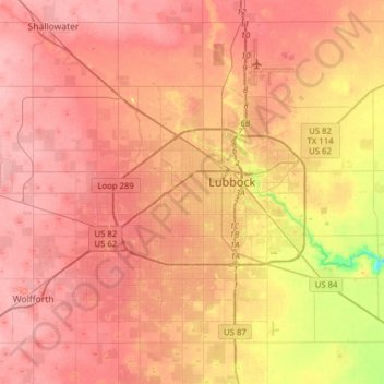
Name: Lubbock topographic map, elevation, terrain.

Location: Lubbock, Lubbock County, Texas, United States (33.44786 -102.03212 33.70843 -101.74901)

Average elevation: 988 m

Minimum elevation: 919 m

Maximum elevation: 1,020 m

Gear up for your next adventure:

🔦UV Flashlight - Detect minerals or specific insects in the dark
🔪Outdoor Multitool - Versatile tool for repairs and food prep in the wild
🥫Freeze-Dried Meals - Lightweight, high-calorie nutrition for multi-day treks
🧶550 Survival Paracord - Versatile utility cord for emergency repairs and rigging
🧢Sun Hat - Wide-brim hat for sun protection

As an Amazon Associate, this site earns from qualifying purchases at no extra cost to you.