

Tafraoui topographic map
Click on the map to display elevation.
About this map

Name: Tafraoui topographic map, elevation, terrain.
Location: Tafraoui, Oued Tlelat District, Oran, 31000, Algeria (35.33350 -0.62654 35.55595 -0.45773)
Average elevation: 345 m
Minimum elevation: 78 m
Maximum elevation: 938 m
Other topographic maps
Click on a map to view its topography, its elevation and its terrain.
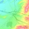
Oued Tlelat
Algeria > Oran > Oued Tlelat District > Oued Tlelat > Oued Tlelat
Average elevation: 145 m