Geolocate

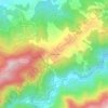
Chebli topographic map

Click on the map to display elevation.

About this map

Name: Chebli topographic map, elevation, terrain.

Location: Chebli, Bouïnian District, Blida, 09000, Algeria (36.51536 2.95971 36.62135 3.06701)

Average elevation: 68 m

Minimum elevation: 29 m

Maximum elevation: 266 m

Other topographic maps

Click on a map to view its topography, its elevation and its terrain.
Sidi Serhane

Algeria > Blida > Bouïnian District > Bouinan

Average elevation: 391 m

Gear up for your next adventure:

🧊Portable Cooler - Keep food and drinks cold during outdoor adventures
🩹Moleskin Blister Pads - Direct protection for painful foot pressure points
🧥Insulated Jacket - Keep warm in cold outdoor conditions
🧢Sun Hat - Wide-brim hat for sun protection
💧Reusable Water Bottle - Durable water bottles for hydration on trails

As an Amazon Associate, this site earns from qualifying purchases at no extra cost to you.