Geolocate

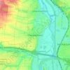
Eberstadt topographic map

Click on the map to display elevation.

About this map

Name: Eberstadt topographic map, elevation, terrain.

Location: Eberstadt, GVV Raum Weinsberg, Landkreis Heilbronn, Baden-Württemberg, 74246, Germany (49.16482 9.29319 49.19991 9.36978)

Average elevation: 248 m

Minimum elevation: 166 m

Maximum elevation: 344 m

Other topographic maps

Click on a map to view its topography, its elevation and its terrain.
Gear up for your next adventure:

🔪Outdoor Multitool - Versatile tool for repairs and food prep in the wild
🏕️Camping Hammock - Integrated protection for sleeping between trees
🛏️Camping Sleeping Mat - Comfortable mats for sleeping outdoors
🧥Packable Rain Jacket - Breathable waterproof layer for unpredictable weather
🔨Vehicle Emergency Tool - Safety tool for remote road trips to trailheads

As an Amazon Associate, this site earns from qualifying purchases at no extra cost to you.