Geolocate

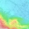
Riccia topographic map

Click on the map to display elevation.

About this map

Name: Riccia topographic map, elevation, terrain.

Location: Riccia, Campobasso, Molise, 86016, Italy (41.42469 14.79018 41.53565 14.90408)

Average elevation: 663 m

Minimum elevation: 208 m

Maximum elevation: 989 m

Other topographic maps

Click on a map to view its topography, its elevation and its terrain.
Maiella

Italy > Molise > Campobasso > Bojano

Average elevation: 648 m

Gear up for your next adventure:

🥾Trail Running Shoes - Lightweight and durable shoes for trail running
🧥Ultralight Puffy Jacket - Maximum warmth that packs down to the size of an orange
🧴Sunscreen SPF - Broad-spectrum sunscreen for outdoor activities
🧼Biodegradable Camp Soap - Environmentally friendly cleaning for gear and body
💡LED Headlamp - Hands-free illumination for night hiking and camping

As an Amazon Associate, this site earns from qualifying purchases at no extra cost to you.