Geolocate

Capesterre-Belle-Eau topographic map

Click on the map to display elevation.

About this map
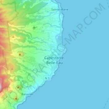
Name: Capesterre-Belle-Eau topographic map, elevation, terrain.

Location: Capesterre-Belle-Eau, Basse-Terre, Guadeloupe, 97130, France (15.98621 -61.68407 16.11091 -61.55526)

Average elevation: 104 m

Minimum elevation: 0 m

Maximum elevation: 821 m

Other topographic maps

Click on a map to view its topography, its elevation and its terrain.

Dugay

France > Guadeloupe > Capesterre-de-Marie-Galante

Average elevation: 104 m

Boissière

France > Guadeloupe > Le Moule

Average elevation: 15 m

Gear up for your next adventure:

🧭GPS Tracker - Track your location in remote areas safely
🧦Merino Wool Socks - Moisture-wicking comfort for long-distance hiking
🥾Trail Hiking Socks - Comfortable socks to prevent blisters and fatigue
🛏️Camping Sleeping Mat - Comfortable mats for sleeping outdoors
🥽Outdoor Goggles - Protective eyewear for outdoor activities

As an Amazon Associate, this site earns from qualifying purchases at no extra cost to you.