
Thank you for supporting this site ❤️
Make a donation
Make a donation
Gear up for your next adventure:
As an Amazon Associate, this site earns from qualifying purchases at no extra cost to you.
Ndeke topographic map
Click on the map to display elevation.
Thank you for supporting this site ❤️
Make a donation
Make a donation
Gear up for your next adventure:
As an Amazon Associate, this site earns from qualifying purchases at no extra cost to you.
About this map
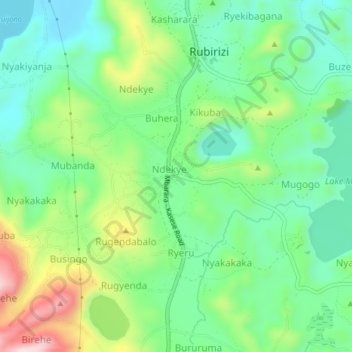
Name: Ndeke topographic map, elevation, terrain.
Location: Ndeke, Rubirizi, Western Region, Uganda (-0.31108 30.08508 -0.27108 30.12508)
Average elevation: 1,371 m
Minimum elevation: 1,256 m
Maximum elevation: 1,605 m
Thank you for supporting this site ❤️
Make a donation
Make a donation
Gear up for your next adventure:
As an Amazon Associate, this site earns from qualifying purchases at no extra cost to you.