

Lorton topographic map
Click on the map to display elevation.
Lorton
According to the United States Census Bureau, the Lorton CDP has a total area of 5.4 square miles (13.9 km2), of which 5.3 square miles (13.7 km2) is land and 0.1 square miles (0.2 km2), or 1.39%, is water. The elevation ranges from sea level at the Prince William County line (the Occoquan River) to slightly over 200 feet (61 m) along Furnace Road at the CDP's western edge.
About this map
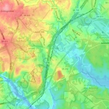
Name: Lorton topographic map, elevation, terrain.
Location: Lorton, Fairfax County, Virginia, United States (38.66653 -77.24575 38.72283 -77.18004)
Average elevation: 37 m
Minimum elevation: -4 m
Maximum elevation: 91 m