Geolocate

Manolo Fortich topographic map

Click on the map to display elevation.

About this map

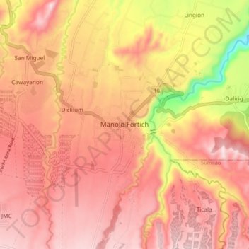
Name: Manolo Fortich topographic map, elevation, terrain.

Location: Manolo Fortich, Bukidnon, Northern Mindanao, Philippines (8.33170 124.82340 8.41170 124.90340)

Average elevation: 501 m

Minimum elevation: 195 m

Maximum elevation: 666 m

Gear up for your next adventure:

🕯️Camping Lantern - Illuminates your entire campsite with high-efficiency LEDs
💡Compact LED Flashlight - Powerful and portable flashlight for outdoor use
🥾Trail Hiking Socks - Comfortable socks to prevent blisters and fatigue
💧Collapsible Water Bottle - Space-saving water bottle for outdoor activities
🧴Outdoor Sunscreen - High SPF protection for high-altitude UV exposure

As an Amazon Associate, this site earns from qualifying purchases at no extra cost to you.