Geolocate

Cologny topographic map

Click on the map to display elevation.

About this map

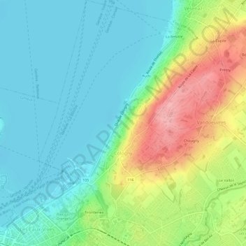
Name: Cologny topographic map, elevation, terrain.

Location: Cologny, Geneva, 1223, Switzerland (46.20133 6.16191 46.24124 6.20175)

Average elevation: 408 m

Minimum elevation: 368 m

Maximum elevation: 496 m

Other topographic maps

Click on a map to view its topography, its elevation and its terrain.

Vésenaz

Switzerland > Geneva

Average elevation: 412 m

Gear up for your next adventure:

🔭Outdoor Binoculars - Lightweight binoculars for birdwatching and hiking
🛰️Satellite Messenger - Emergency communication for areas with no cell service
Lightweight Camping Tent - Portable shelter optimized for Canadian backcountry camping
🧴Outdoor Sunscreen - High SPF protection for high-altitude UV exposure
🐕Hiking Dog Pack - Let your canine companion carry their own water and food

As an Amazon Associate, this site earns from qualifying purchases at no extra cost to you.