Geolocate

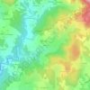
Salette topographic map

Click on the map to display elevation.

About this map

Name: Salette topographic map, elevation, terrain.

Location: Salette, Usson-en-Forez, Montbrison, Loire, Auvergne-Rhône-Alpes, France métropolitaine, 42550, France (45.38683 3.95357 45.38880 3.95513)

Average elevation: 926 m

Minimum elevation: 877 m

Maximum elevation: 979 m

Other topographic maps

Click on a map to view its topography, its elevation and its terrain.
Salayes

France > Auvergne-Rhône-Alpes > Loire > Usson-en-Forez

Average elevation: 915 m

Salette

France > Auvergne-Rhône-Alpes > Loire > Usson-en-Forez > Salette

Average elevation: 929 m

42550

France > Auvergne-Rhône-Alpes > Loire > Usson-en-Forez

Average elevation: 907 m

Daniecq

France > Auvergne-Rhône-Alpes > Loire > Usson-en-Forez

Average elevation: 948 m

Bourette

France > Auvergne-Rhône-Alpes > Loire > Usson-en-Forez

Average elevation: 934 m

Boulaine

France > Auvergne-Rhône-Alpes > Loire > Usson-en-Forez

Average elevation: 967 m

Gear up for your next adventure:

🥾Mountain Hiking Boots - High-traction boots for rocky terrain
⛺Lightweight Backpacking Tent - Compact tent for efficient hiking trips
🎒Fully Waterproof Backpack - Total protection for photography gear and electronics
👟Trail Running Shoes - Agile footwear for fast-paced topographic exploration
👟Leg Gaiters - Keep debris, mud, and snow out of your boots

As an Amazon Associate, this site earns from qualifying purchases at no extra cost to you.