Geolocate

11 topographic map

Click on the map to display elevation.

About this map

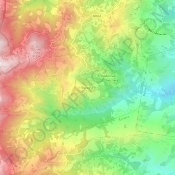
Name: 11 topographic map, elevation, terrain.

Location: 11, Boragne, Brittoli, Pescara, Abruzzo, 65010, Italy (42.28150 13.84789 42.32150 13.88789)

Average elevation: 603 m

Minimum elevation: 305 m

Maximum elevation: 934 m

Gear up for your next adventure:

🎒Fully Waterproof Backpack - Total protection for photography gear and electronics
🛶Kayak Dry Bag - Waterproof storage for kayaking adventures
🥾Durable Hiking Shoes - Long-lasting shoes for frequent hiking
🛌Insulated Sleeping Pad - Critical thermal barrier between you and the cold ground
🥾Light Hiking Boots - Lightweight and comfortable boots for day hikes

As an Amazon Associate, this site earns from qualifying purchases at no extra cost to you.