Geolocate

San Jose topographic map

Click on the map to display elevation.

About this map
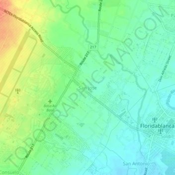
Name: San Jose topographic map, elevation, terrain.

Location: San Jose, Floridablanca, Pampanga, Central Luzon, 2007, Philippines (14.96473 120.49221 15.00473 120.53221)

Average elevation: 32 m

Minimum elevation: 16 m

Maximum elevation: 59 m

Other topographic maps

Click on a map to view its topography, its elevation and its terrain.

Anon

Philippines > Pampanga > Floridablanca

Average elevation: 16 m

Calantas

Philippines > Pampanga > Floridablanca

Average elevation: 50 m

Gear up for your next adventure:

🧥Softshell Hiking Jacket - The perfect balance of wind protection and breathability
🧢Hiking Sun Hat - Wide-brimmed protection for exposed mountain ridges
👖Convertible Hiking Pants - Zip-off legs to adapt to changing weather conditions
🦯Trekking Poles - Reduced impact on joints for steep topographic climbs
🛁Quick-Dry Microfiber Towel - Space-saving towel that dries rapidly on the move

As an Amazon Associate, this site earns from qualifying purchases at no extra cost to you.