
Ceaux-en-Couhé topographic map
Interactive map
Click on the map to display elevation.
About this map
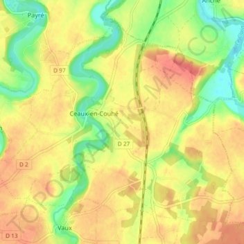
Name: Ceaux-en-Couhé topographic map, elevation, terrain.
Average elevation: 129 m
Minimum elevation: 96 m
Maximum elevation: 154 m
Other topographic maps
Click on a map to view its topography, its elevation and its terrain.
Le Grand Cormy
France > Nouvelle-Aquitaine > Vienne > Valence-en-Poitou
Le Grand Cormy, Vaux, Valence-en-Poitou, Montmorillon, Vienne, Nouvelle-Aquitaine, France métropolitaine, 86700, France
Average elevation: 142 m