Geolocate

The Cedars topographic map

Click on the map to display elevation.

About this map

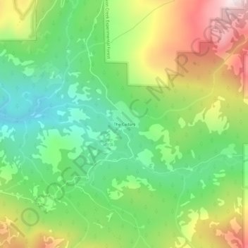
Name: The Cedars topographic map, elevation, terrain.

Location: The Cedars, Placer County, California, United States (39.23296 -120.37326 39.27296 -120.33326)

Average elevation: 1,904 m

Minimum elevation: 1,628 m

Maximum elevation: 2,329 m

Other topographic maps

Click on a map to view its topography, its elevation and its terrain.

Avery's Pond

United States > California > Placer County

Average elevation: 189 m

Lincoln

United States > California > Placer County

Average elevation: 60 m

Tahoe Vista

United States > California > Placer County > Kings Beach

Average elevation: 2,025 m

Lincoln

United States > California > Placer County

Average elevation: 34 m

Dollar Point

United States > California > Placer County

Average elevation: 1,955 m

Auburn Ravine

United States > California > Placer County > Auburn

Average elevation: 248 m

Deer Lake

United States > California > Placer County

Average elevation: 2,019 m

Gear up for your next adventure:

🧦Crew Hiking Socks - Comfortable socks for long-distance hikes
💡Compact LED Flashlight - Powerful and portable flashlight for outdoor use
🥾Waterproof Hiking Boots - Boots keeping your feet dry in wet conditions
🚲Heavy Duty Bike Lock - Secure your bike at the trailhead or during stops
🥾Hiking Leggings - Comfortable leggings for outdoor activities

As an Amazon Associate, this site earns from qualifying purchases at no extra cost to you.