Geolocate

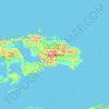
Los topographic map

Click on the map to display elevation.

About this map

Name: Los topographic map, elevation, terrain.

Location: Los, Raja Ampat, Southwest Papua, Western New Guinea, Indonesia (-2.43917 129.99111 -1.79917 130.63111)

Average elevation: 28 m

Minimum elevation: -1 m

Maximum elevation: 430 m

Other topographic maps

Click on a map to view its topography, its elevation and its terrain.

Gam Island

Indonesia > Southwest Papua > Raja Ampat

Average elevation: 1 m

Pulau Waigeo

Indonesia > Southwest Papua > Raja Ampat

The area of the island is 3,155 square kilometres (1,218 square miles); the highest elevations are 958-metre-high (3,143-foot) Buffalo Horn (Gunung Nok) and 939-metre-high (3,081-foot) Serodjil. From west to east, the island measures approximately 110 km (68 mi), north–south about 50 kilometres (31 miles).

Average elevation: 37 m

Pulau Batanta

Indonesia > Southwest Papua > Raja Ampat

Average elevation: 57 m

Pulau Mansuar

Indonesia > Southwest Papua > Raja Ampat > Kurkapa

Average elevation: 11 m

Gear up for your next adventure:

⛺Camping Tent - Weather-resistant tents suitable for 2 to 6 people
🛶Kayak Dry Bag - Waterproof storage for kayaking adventures
🔨Vehicle Emergency Tool - Safety tool for remote road trips to trailheads
⛺Bushcraft Tarp - Versatile emergency shelter or gear protection
🦶Hiking Shoe Insoles - Added support for high arches and long days on feet

As an Amazon Associate, this site earns from qualifying purchases at no extra cost to you.