Geolocate

Marconaga topographic map

Click on the map to display elevation.

About this map
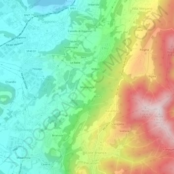
Name: Marconaga topographic map, elevation, terrain.

Location: Marconaga, Ello, Lecco, Lombardia, 23886, Italia (45.75676 9.33949 45.79676 9.37949)

Average elevation: 465 m

Minimum elevation: 223 m

Maximum elevation: 878 m

Gear up for your next adventure:

🧢Beanie Hat - Keep your head warm in cold weather
🧦Hiking Liner Socks - Thin base layer to prevent friction and blisters
💡Solar Camping Lamp - Eco-friendly lighting for campsites
🥾Light Trekking Boots - Supportive boots for multi-day treks
🩹Compact First Aid Kit - Pre-packed essentials for common trail injuries

As an Amazon Associate, this site earns from qualifying purchases at no extra cost to you.