Geolocate

Umarizeiras topographic map

Click on the map to display elevation.

About this map
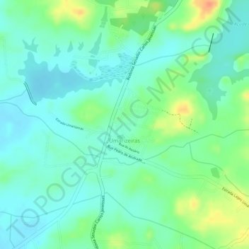
Name: Umarizeiras topographic map, elevation, terrain.

Location: Umarizeiras, Maranguape, Região Geográfica Imediata de Fortaleza, Região Geográfica Intermediária de Fortaleza, Ceará, Região Nordeste, Brasil (-4.01082 -38.72991 -4.00184 -38.72267)

Average elevation: 129 m

Minimum elevation: 113 m

Maximum elevation: 159 m

Other topographic maps

Click on a map to view its topography, its elevation and its terrain.

Ladeira Grande

Brasil > Ceará > Maranguape

Average elevation: 134 m

Antônio Marques

Brasil > Ceará > Maranguape > Antônio Marques

Average elevation: 169 m

Rio Pirapora

Brasil > Ceará > Maranguape

Average elevation: 54 m

Vertentes do Lagedo

Brasil > Ceará > Maranguape

Average elevation: 108 m

Gear up for your next adventure:

🥾Waterproof Hiking Boots - Essential footwear for rugged terrain and wet Canadian trails
🥾Waterproof Hiking Shoes - Durable shoes for wet and rugged trails
🎒Hiking Backpack - Lightweight and ergonomic backpacks for day hikes or multi-day treks
🥤Collapsible Travel Cup - Saves space and weight in your mess kit
🔋Solar Power Bank - Keep your GPS and devices charged during long outdoor trips

As an Amazon Associate, this site earns from qualifying purchases at no extra cost to you.