Geolocate

Kiharong topographic map

Click on the map to display elevation.

About this map

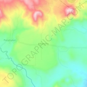
Name: Kiharong topographic map, elevation, terrain.

Location: Kiharong, Maramag, Bukidnon, Northern Mindanao, Philippines (7.83923 124.97277 7.87923 125.01277)

Average elevation: 575 m

Minimum elevation: 443 m

Maximum elevation: 782 m

Gear up for your next adventure:

🧼Biodegradable Camp Soap - Environmentally friendly cleaning for gear and body
💡Solar Camping Lamp - Eco-friendly lighting for campsites
🥾All-Terrain Hiking Boots - Versatile boots for varied hiking conditions
🥾Light Hiking Boots - Lightweight and comfortable boots for day hikes
💡LED Headlamp - Hands-free illumination for night hiking and camping

As an Amazon Associate, this site earns from qualifying purchases at no extra cost to you.