Geolocate

Kaiseraugst topographic map

Click on the map to display elevation.

About this map

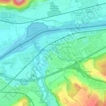
Name: Kaiseraugst topographic map, elevation, terrain.

Location: Kaiseraugst, Bezirk Rheinfelden, Aargau, 4303, Switzerland (47.52499 7.71347 47.54500 7.76356)

Average elevation: 293 m

Minimum elevation: 258 m

Maximum elevation: 407 m

Gear up for your next adventure:

🔋Lithium AA Batteries - Long-lasting power that performs in extreme cold
🧥Waterproof Pants - Keep dry during rainy hiking conditions
💧Collapsible Water Bottle - Space-saving water bottle for outdoor activities
🧥Waterproof Jacket - Lightweight rain jackets for hiking and outdoor activities
🥤Collapsible Travel Cup - Saves space and weight in your mess kit

As an Amazon Associate, this site earns from qualifying purchases at no extra cost to you.