
Cerro de Chapultepec topographic map
Interactive map
Click on the map to display elevation.
About this map
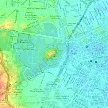
Name: Cerro de Chapultepec topographic map, elevation, terrain.
Location: Cerro de Chapultepec, Ciudad de México, 11590, México (19.41996 -99.18152 19.42006 -99.18142)
Average elevation: 2,250 m
Minimum elevation: 2,235 m
Maximum elevation: 2,289 m
Other topographic maps
Click on a map to view its topography, its elevation and its terrain.