
Port Rexton topographic map
Interactive map
Click on the map to display elevation.
About this map
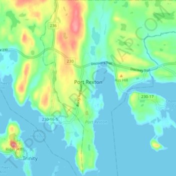
Name: Port Rexton topographic map, elevation, terrain.
Location: Port Rexton, Newfoundland and Labrador, Canada (48.36366 -53.35317 48.41461 -53.28357)
Average elevation: 25 m
Minimum elevation: -2 m
Maximum elevation: 105 m