

Mardan topographic map
Click on the map to display elevation.
Mardan
Mardan is located in the south west of the district at 34°12'0N 72°1'60E and an altitude of 283 metres (928 ft). Mardan is a district headquarter of Mardan District of Khyber Pakhtunkhwa. Risalpur is located to the south, Charsadda is located to the west, Yar Hussain to the east and Takht Bahi & Katlang to the north. It is the second largest city in Khyber Pakhtunkhwa while 19th largest city of Pakistan.
About this map
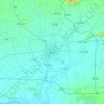
Name: Mardan topographic map, elevation, terrain.
Average elevation: 328 m
Minimum elevation: 284 m
Maximum elevation: 894 m
Other topographic maps
Click on a map to view its topography, its elevation and its terrain.


