Geolocate

Clots topographic map

Click on the map to display elevation.

About this map

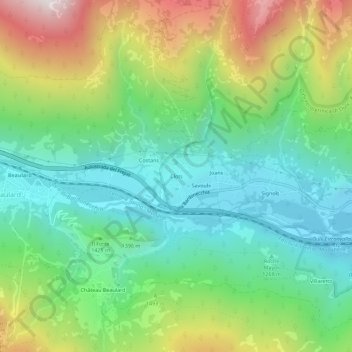
Name: Clots topographic map, elevation, terrain.

Location: Clots, Oulx, Torino, Piedmont, 10056, Italy (45.02568 6.76504 45.06568 6.80504)

Average elevation: 1,445 m

Minimum elevation: 1,078 m

Maximum elevation: 2,166 m

Gear up for your next adventure:

🛌Down Sleeping Bag - Superior warmth-to-weight ratio for cold nights
🦯Trekking Poles - Reduced impact on joints for steep topographic climbs
🔦LED Headtorch - Bright and durable light for night activities
🧥Waterproof Pants - Keep dry during rainy hiking conditions
🥘Camping Cookware Set - Compact nesting pots and pans for trail cooking

As an Amazon Associate, this site earns from qualifying purchases at no extra cost to you.