Geolocate

Mount Hope topographic map

Click on the map to display elevation.

About this map

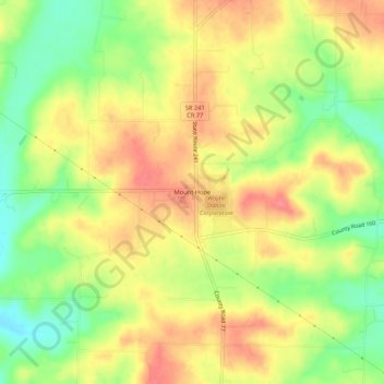
Name: Mount Hope topographic map, elevation, terrain.

Location: Mount Hope, Holmes County, Ohio, 44660, United States (40.60398 -81.80473 40.64398 -81.76473)

Average elevation: 364 m

Minimum elevation: 321 m

Maximum elevation: 400 m

Other topographic maps

Click on a map to view its topography, its elevation and its terrain.

Lake Buckhorn

United States > Ohio > Holmes County > Clark

Average elevation: 300 m

Holmesville

United States > Ohio > Holmes County

Average elevation: 262 m

Nashville

United States > Ohio > Holmes County

Average elevation: 363 m

Gear up for your next adventure:

🧤Insulated Winter Gloves - Heavy-duty protection for sub-zero Canadian adventures
🧣Merino Neck Gaiter - Protects against wind, sun, and cold at high altitudes
🚲Bike Repair Kit - Essential tools for on-trail mechanical issues
🛁Quick-Dry Microfiber Towel - Space-saving towel that dries rapidly on the move
Camping Tent - Weather-resistant tents suitable for 2 to 6 people

As an Amazon Associate, this site earns from qualifying purchases at no extra cost to you.