
Den Nul topographic map
Interactive map
Click on the map to display elevation.
About this map
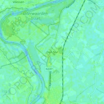
Name: Den Nul topographic map, elevation, terrain.
Location: Den Nul, Overijssel, Niederlande, 8121, Niederlande (52.33778 6.09024 52.37778 6.13024)
Average elevation: 4 m
Minimum elevation: -6 m
Maximum elevation: 9 m