Geolocate

Bastia topographic map

Click on the map to display elevation.

About this map

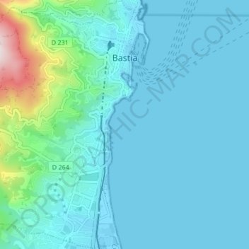
Name: Bastia topographic map, elevation, terrain.

Location: Bastia, Upper Corsica, Corsica, Metropolitan France, France (42.66121 9.39017 42.71089 9.45765)

Average elevation: 67 m

Minimum elevation: -3 m

Maximum elevation: 537 m

Gear up for your next adventure:

Lightweight Backpacking Tent - Compact tent for efficient hiking trips
🕯️Camping Lantern - Illuminates your entire campsite with high-efficiency LEDs
🧴Waterproofing Spray - Restore the DWR coating on jackets and tents
🧰Survival Kit - Essential gear for emergencies in the wilderness
❄️Traction Ice Cleats - Slip-on spikes for icy trails and winter hiking

As an Amazon Associate, this site earns from qualifying purchases at no extra cost to you.