
Thank you for supporting this site ❤️
Make a donation
Make a donation
Gear up for your next adventure:
As an Amazon Associate, this site earns from qualifying purchases at no extra cost to you.
Ranipet topographic map
Click on the map to display elevation.
Thank you for supporting this site ❤️
Make a donation
Make a donation
Gear up for your next adventure:
As an Amazon Associate, this site earns from qualifying purchases at no extra cost to you.
About this map
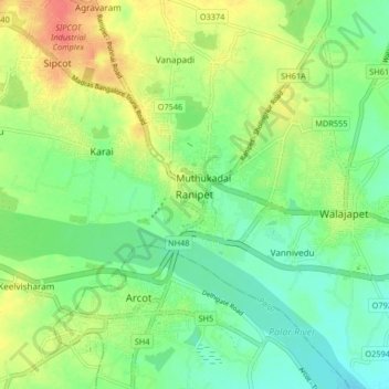
Name: Ranipet topographic map, elevation, terrain.
Location: Ranipet, Wallajah, Ranipet District, Tamil Nadu, 632401, India (12.88925 79.29217 12.96925 79.37217)
Average elevation: 172 m
Minimum elevation: 151 m
Maximum elevation: 203 m
Thank you for supporting this site ❤️
Make a donation
Make a donation
Gear up for your next adventure:
As an Amazon Associate, this site earns from qualifying purchases at no extra cost to you.