Geolocate

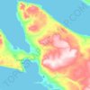
Daniel Island topographic map

Click on the map to display elevation.

About this map

Name: Daniel Island topographic map, elevation, terrain.

Location: Daniel Island, Qikiqtaaluk Region, Nunavut, Canada (63.08912 -67.77790 63.11240 -67.68948)

Average elevation: 32 m

Minimum elevation: -2 m

Maximum elevation: 312 m

Other topographic maps

Click on a map to view its topography, its elevation and its terrain.

Mount Asgard

Canada > Nunavut > Qikiqtaaluk Region

Average elevation: 1,201 m

Arctic Bay

Canada > Nunavut > Qikiqtaaluk Region

Arctic Bay experiences a tundra climate (Köppen: ET) like most northern Canadian territories at low elevations, with long, very cold winters and short, cool to cold summers. July is the only month with an average low temperature above freezing. Its climate does not differ from the more severe subarctic…

Average elevation: 160 m

Fellfoot Point

Canada > Nunavut > Qikiqtaaluk Region

Average elevation: 2 m

Horizon Hill

Canada > Nunavut > Qikiqtaaluk Region

Average elevation: 139 m

Bjorne Peninsula

Canada > Nunavut > Qikiqtaaluk Region

Average elevation: 155 m

Cape Rosamond

Canada > Nunavut > Qikiqtaaluk Region

Average elevation: 3 m

Gear up for your next adventure:

🥾Mountaineering Boots - Supportive boots for climbing and high-altitude hiking
🦌Outdoor Trail Camera - Monitor wildlife activity near your favorite spots
🎒Hiking Daypack - Lightweight and durable backpacks for day trips and excursions
🧴Outdoor Sunscreen - High SPF protection for high-altitude UV exposure
🛰️Satellite Messenger - Emergency communication for areas with no cell service

As an Amazon Associate, this site earns from qualifying purchases at no extra cost to you.