Geolocate

Sangkalang topographic map

Click on the map to display elevation.

About this map

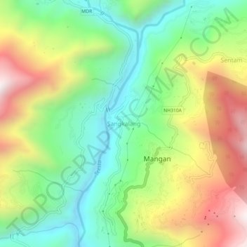
Name: Sangkalang topographic map, elevation, terrain.

Location: Sangkalang, Mangan, Sikkim, 737116, India (27.48683 88.50943 27.52683 88.54943)

Average elevation: 1,166 m

Minimum elevation: 694 m

Maximum elevation: 1,873 m

Other topographic maps

Click on a map to view its topography, its elevation and its terrain.

Goecha La Lake

India > Sikkim > Mangan

Average elevation: 4,953 m

Gear up for your next adventure:

🔦LED Headtorch - Bright and durable light for night activities
Lightweight Camping Tent - Portable shelter optimized for Canadian backcountry camping
🧥Softshell Jacket - Windproof and breathable jacket for hiking
🚲Bike Repair Kit - Essential tools for on-trail mechanical issues
🧭GPS Handheld Device - Reliable GPS navigation for outdoor adventures

As an Amazon Associate, this site earns from qualifying purchases at no extra cost to you.