
Thank you for supporting this site ❤️
Make a donation
Make a donation
Gear up for your next adventure:
As an Amazon Associate, this site earns from qualifying purchases at no extra cost to you.
Camalig topographic map
Click on the map to display elevation.
Thank you for supporting this site ❤️
Make a donation
Make a donation
Gear up for your next adventure:
As an Amazon Associate, this site earns from qualifying purchases at no extra cost to you.
About this map
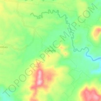
Name: Camalig topographic map, elevation, terrain.
Location: Camalig, Banisilan, North Cotabato, Soccsksargen, Philippines (7.51215 124.71486 7.55215 124.75486)
Average elevation: 443 m
Minimum elevation: 342 m
Maximum elevation: 587 m
Thank you for supporting this site ❤️
Make a donation
Make a donation
Gear up for your next adventure:
As an Amazon Associate, this site earns from qualifying purchases at no extra cost to you.