
Bras-Panon topographic map
Interactive map
Click on the map to display elevation.
About this map
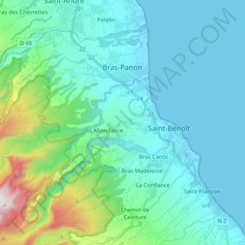
Name: Bras-Panon topographic map, elevation, terrain.
Location: Bras-Panon, Saint-Benoît, Réunion, 97412, Frankreich (-21.08530 55.55224 -20.97465 55.70102)
Average elevation: 211 m
Minimum elevation: 0 m
Maximum elevation: 1,328 m