
El Paso topographic map
Interactive map
Click on the map to display elevation.
About this map
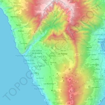
Name: El Paso topographic map, elevation, terrain.
Location: El Paso, Santa Cruz de Tenerife, Canarische Eilanden, Spanje (28.55349 -17.92647 28.76164 -17.82286)
Average elevation: 733 m
Minimum elevation: 0 m
Maximum elevation: 2,422 m