Geolocate

Bungol topographic map

Click on the map to display elevation.

About this map

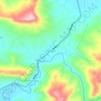
Name: Bungol topographic map, elevation, terrain.

Location: Bungol, Balaoan, La Union, Ilocos Region, 2520, Philippines (16.75099 120.38657 16.79099 120.42657)

Average elevation: 109 m

Minimum elevation: 14 m

Maximum elevation: 311 m

Gear up for your next adventure:

🥤Collapsible Travel Cup - Saves space and weight in your mess kit
🏃Hydration Running Vest - Carry water and maps close to your body for speed
💡Solar Camping Lamp - Eco-friendly lighting for campsites
🌬️Windproof Camp Stove - Efficient cooking even on exposed mountain peaks
👖Convertible Hiking Pants - Zip-off legs to adapt to changing weather conditions

As an Amazon Associate, this site earns from qualifying purchases at no extra cost to you.