
Thank you for supporting this site ❤️
Make a donation
Make a donation
Gear up for your next adventure:
As an Amazon Associate, this site earns from qualifying purchases at no extra cost to you.
Clariana topographic map
Click on the map to display elevation.
Thank you for supporting this site ❤️
Make a donation
Make a donation
Gear up for your next adventure:
As an Amazon Associate, this site earns from qualifying purchases at no extra cost to you.
About this map
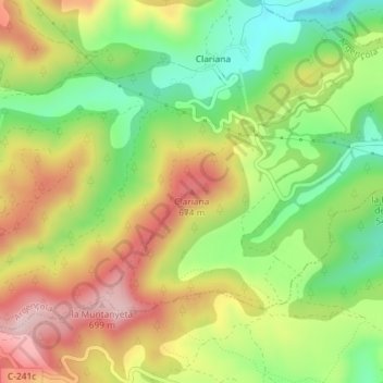
Name: Clariana topographic map, elevation, terrain.
Location: Clariana, Argençola, Anoia, Barcelona, Cataluña, 08717, España (41.58160 1.49613 41.58170 1.49623)
Average elevation: 550 m
Minimum elevation: 413 m
Maximum elevation: 704 m
Thank you for supporting this site ❤️
Make a donation
Make a donation
Gear up for your next adventure:
As an Amazon Associate, this site earns from qualifying purchases at no extra cost to you.