Geolocate

Hominy topographic map

Click on the map to display elevation.

About this map

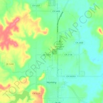
Name: Hominy topographic map, elevation, terrain.

Location: Hominy, Osage County, Oklahoma, 74035, United States (36.40159 -96.40731 36.47047 -96.36707)

Average elevation: 253 m

Minimum elevation: 223 m

Maximum elevation: 317 m

Gear up for your next adventure:

🧴Insect Repellent - Protect yourself from bugs during outdoor adventures
🥾Waterproof Hiking Boots - Boots keeping your feet dry in wet conditions
📷Outdoor Action Camera - Capture high-elevation views and rugged adventures
Camping Coffee Maker - Brew fresh coffee anywhere on the topographic map
🥾Lightweight Hiking Boots - Boots for comfort and mobility on long hikes

As an Amazon Associate, this site earns from qualifying purchases at no extra cost to you.