Geolocate

Manalithara topographic map

Click on the map to display elevation.

About this map

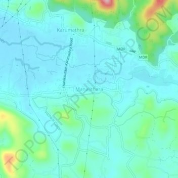
Name: Manalithara topographic map, elevation, terrain.

Location: Manalithara, Talappilly, Thrissur, Kerala, 680589, India (10.61618 76.25979 10.65618 76.29979)

Average elevation: 60 m

Minimum elevation: 24 m

Maximum elevation: 229 m

Other topographic maps

Click on a map to view its topography, its elevation and its terrain.

Pazhayannur

India > Kerala > Talappilly > Pazhayanur

Average elevation: 80 m

Gear up for your next adventure:

🧦Hiking Socks - Moisture-wicking and comfortable socks for long hikes
🎒Fully Waterproof Backpack - Total protection for photography gear and electronics
🧭GPS Handheld Device - Reliable GPS navigation for outdoor adventures
🧦Crew Hiking Socks - Comfortable socks for long-distance hikes
🥾Approach Boots - Comfortable boots for hiking and climbing approaches

As an Amazon Associate, this site earns from qualifying purchases at no extra cost to you.