
Make a donation
Gear up for your next adventure:
As an Amazon Associate, this site earns from qualifying purchases at no extra cost to you.
Puerto Galilea topographic map
Click on the map to display elevation.
Make a donation
Gear up for your next adventure:
As an Amazon Associate, this site earns from qualifying purchases at no extra cost to you.
Puerto Galilea
Puerto Galilea es una localidad peruana ubicada en la región Amazonas, provincia de Condorcanqui, distrito de Río Santiago. Es asimismo capital del distrito de Río Santiago. Se encuentra a una altitud de 192 m s. n. m. Tenía una población de 440 habitantes en 1993.
Make a donation
Gear up for your next adventure:
As an Amazon Associate, this site earns from qualifying purchases at no extra cost to you.
About this map
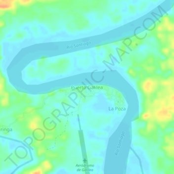
Name: Puerto Galilea topographic map, elevation, terrain.
Location: Puerto Galilea, Río Santiago, Condorcanqui, Amazonas, Perú (-4.03509 -77.77834 -3.99509 -77.73834)
Average elevation: 183 m
Minimum elevation: 174 m
Maximum elevation: 211 m
Make a donation
Gear up for your next adventure:
As an Amazon Associate, this site earns from qualifying purchases at no extra cost to you.