Geolocate

Lichtenau topographic map

Click on the map to display elevation.

About this map

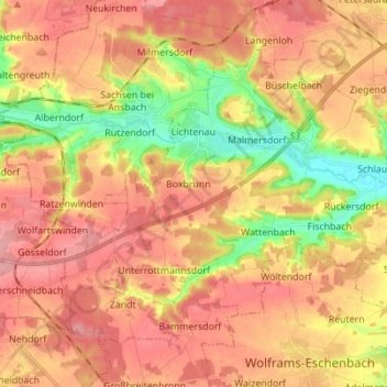
Name: Lichtenau topographic map, elevation, terrain.

Location: Lichtenau, Landkreis Ansbach, Bayern, 91586, Deutschland (49.23016 10.63614 49.30185 10.77440)

Average elevation: 443 m

Minimum elevation: 382 m

Maximum elevation: 482 m

Gear up for your next adventure:

🦶Anti-Blister Balm - Prevents friction and hotspots during long ascents
💧Reusable Water Bottle - Durable water bottles for hydration on trails
🏕️Camping Hammock - Integrated protection for sleeping between trees
🛌Insulated Sleeping Pad - Critical thermal barrier between you and the cold ground
🧦Hiking Socks - Moisture-wicking and comfortable socks for long hikes

As an Amazon Associate, this site earns from qualifying purchases at no extra cost to you.