Geolocate

Etalin topographic map

Click on the map to display elevation.

About this map

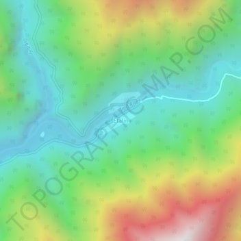
Name: Etalin topographic map, elevation, terrain.

Location: Etalin, Etalin Circle, Dibang Valley, Arunachal Pradesh, India (28.58820 95.85247 28.62820 95.89247)

Average elevation: 1,174 m

Minimum elevation: 592 m

Maximum elevation: 2,331 m

Other topographic maps

Click on a map to view its topography, its elevation and its terrain.

Emra river

India > Arunachal Pradesh > Etalin Circle

Average elevation: 1,467 m

Gear up for your next adventure:

🕶️Polarized Sunglasses - Reduces glare from snow and water at high elevations
🥾Trekking Boots - Durable boots for long-distance trekking
🧼Biodegradable Camp Soap - Environmentally friendly cleaning for gear and body
🥾Hiking Leggings - Comfortable leggings for outdoor activities
🥾Approach Shoes - Shoes designed for climbing approaches and rugged trails

As an Amazon Associate, this site earns from qualifying purchases at no extra cost to you.