
Thank you for supporting this site ❤️
Make a donation
Make a donation
Gear up for your next adventure:
As an Amazon Associate, this site earns from qualifying purchases at no extra cost to you.
Bujalcayado topographic map
Click on the map to display elevation.
Thank you for supporting this site ❤️
Make a donation
Make a donation
Gear up for your next adventure:
As an Amazon Associate, this site earns from qualifying purchases at no extra cost to you.
About this map
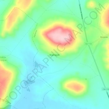
Name: Bujalcayado topographic map, elevation, terrain.
Location: Bujalcayado, Sigüenza, Guadalajara, Castilla-La Mancha, España (41.10784 -2.73477 41.14784 -2.69477)
Average elevation: 980 m
Minimum elevation: 917 m
Maximum elevation: 1,125 m
Thank you for supporting this site ❤️
Make a donation
Make a donation
Gear up for your next adventure:
As an Amazon Associate, this site earns from qualifying purchases at no extra cost to you.
Other topographic maps
Click on a map to view its topography, its elevation and its terrain.