
Thank you for supporting this site ❤️
Make a donation
Make a donation
Gear up for your next adventure:
As an Amazon Associate, this site earns from qualifying purchases at no extra cost to you.
Bochones topographic map
Click on the map to display elevation.
Thank you for supporting this site ❤️
Make a donation
Make a donation
Gear up for your next adventure:
As an Amazon Associate, this site earns from qualifying purchases at no extra cost to you.
About this map
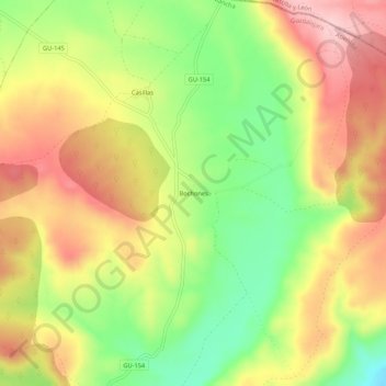
Name: Bochones topographic map, elevation, terrain.
Location: Bochones, Atienza, Guadalajara, Castilla-La Mancha, España (41.22752 -2.87517 41.26752 -2.83517)
Average elevation: 1,159 m
Minimum elevation: 1,052 m
Maximum elevation: 1,258 m
Thank you for supporting this site ❤️
Make a donation
Make a donation
Gear up for your next adventure:
As an Amazon Associate, this site earns from qualifying purchases at no extra cost to you.