Geolocate

Soula topographic map

Click on the map to display elevation.

About this map
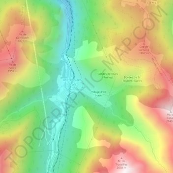
Name: Soula topographic map, elevation, terrain.

Location: Soula, Mérens-les-Vals, Foix, Ariège, Occitanie, France métropolitaine, 09110, France (42.63760 1.82141 42.67760 1.86141)

Average elevation: 1,490 m

Minimum elevation: 967 m

Maximum elevation: 2,138 m

Other topographic maps

Click on a map to view its topography, its elevation and its terrain.
Étang des Bésines

France > Occitanie > Ariège > Mérens-les-Vals

Average elevation: 2,240 m

Gear up for your next adventure:

🧥Waterproof Hiking Jacket - Protect yourself from rain and wind while hiking
⛺Lightweight Camping Tent - Portable shelter optimized for Canadian backcountry camping
🥾Hiking Shorts - Breathable shorts suitable for summer hikes
🧭GPS Tracker - Track your location in remote areas safely
🦶Hiking Shoe Insoles - Added support for high arches and long days on feet

As an Amazon Associate, this site earns from qualifying purchases at no extra cost to you.