Geolocate

Sabanalarga topographic map

Click on the map to display elevation.

About this map

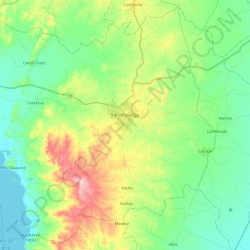
Name: Sabanalarga topographic map, elevation, terrain.

Location: Sabanalarga, Atlántico, Colombia (10.51714 -75.06337 10.72594 -74.83907)

Average elevation: 68 m

Minimum elevation: 3 m

Maximum elevation: 210 m

Gear up for your next adventure:

Camping Essentials - All-in-one gear for a comfortable camping trip
🏃Hydration Running Vest - Carry water and maps close to your body for speed
🚑Survival Whistle - Signal for help across long distances in mountains
💧Filtered Water Bottle - Safe drinking water on the go
🥾Trail Hiking Socks - Comfortable socks to prevent blisters and fatigue

As an Amazon Associate, this site earns from qualifying purchases at no extra cost to you.