
Thank you for supporting this site ❤️
Make a donation
Make a donation
Gear up for your next adventure:
As an Amazon Associate, this site earns from qualifying purchases at no extra cost to you.
Oriñón topographic map
Click on the map to display elevation.
Thank you for supporting this site ❤️
Make a donation
Make a donation
Gear up for your next adventure:
As an Amazon Associate, this site earns from qualifying purchases at no extra cost to you.
About this map
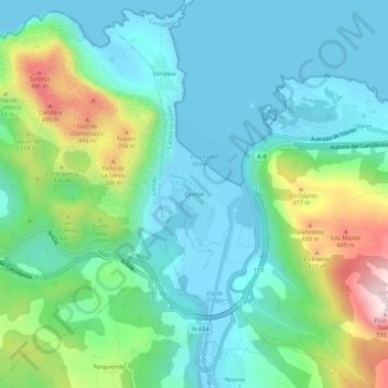
Name: Oriñón topographic map, elevation, terrain.
Location: Oriñón, Castro-Urdiales, Kantabrien, 39780, Spanien (43.37731 -3.34348 43.41731 -3.30348)
Average elevation: 140 m
Minimum elevation: -3 m
Maximum elevation: 561 m
Thank you for supporting this site ❤️
Make a donation
Make a donation
Gear up for your next adventure:
As an Amazon Associate, this site earns from qualifying purchases at no extra cost to you.