Geolocate

Cala Egos topographic map

Click on the map to display elevation.

About this map

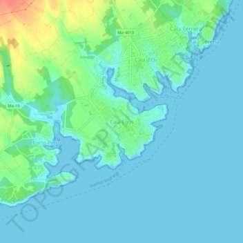
Name: Cala Egos topographic map, elevation, terrain.

Location: Cala Egos, Santanyí, Migjorn, Balearic Islands, 07660, Spain (39.34471 3.20519 39.38471 3.24519)

Average elevation: 11 m

Minimum elevation: -1 m

Maximum elevation: 54 m

Gear up for your next adventure:

🦶Hiking Shoe Insoles - Added support for high arches and long days on feet
🥾Light Hiking Boots - Lightweight and comfortable boots for day hikes
🥽Outdoor Goggles - Protective eyewear for outdoor activities
🚲Handlebar Phone Mount - View topographic-map.com live while cycling
🥾Mountain Hiking Boots - High-traction boots for rocky terrain

As an Amazon Associate, this site earns from qualifying purchases at no extra cost to you.