
St. Johann bei Herberstein topographic map
Interactive map
Click on the map to display elevation.
About this map
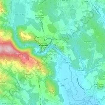
Name: St. Johann bei Herberstein topographic map, elevation, terrain.
Average elevation: 426 m
Minimum elevation: 348 m
Maximum elevation: 658 m
Other topographic maps
Click on a map to view its topography, its elevation and its terrain.
Kaibing
Österreich > Steiermark > Bezirk Hartberg-Fürstenfeld > Feistritztal
Kaibing, Feistritztal, Bezirk Hartberg-Fürstenfeld, Steiermark, 8221, Österreich
Average elevation: 393 m