
Thank you for supporting this site ❤️
Make a donation
Make a donation
Gear up for your next adventure:
As an Amazon Associate, this site earns from qualifying purchases at no extra cost to you.
Steinach topographic map
Click on the map to display elevation.
Thank you for supporting this site ❤️
Make a donation
Make a donation
Gear up for your next adventure:
As an Amazon Associate, this site earns from qualifying purchases at no extra cost to you.
About this map
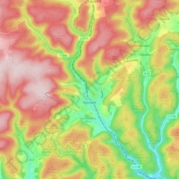
Name: Steinach topographic map, elevation, terrain.
Location: Steinach, Landkreis Sonneberg, Thuringia, 96523, Germany (50.39923 11.10861 50.47543 11.20282)
Average elevation: 653 m
Minimum elevation: 439 m
Maximum elevation: 838 m
Thank you for supporting this site ❤️
Make a donation
Make a donation
Gear up for your next adventure:
As an Amazon Associate, this site earns from qualifying purchases at no extra cost to you.