Geolocate

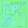
Shell Island topographic map

Click on the map to display elevation.

About this map

Name: Shell Island topographic map, elevation, terrain.

Location: Shell Island, Collier County, Florida, United States (25.70537 -82.05592 26.34537 -81.41592)

Average elevation: 2 m

Minimum elevation: -3 m

Maximum elevation: 26 m

Other topographic maps

Click on a map to view its topography, its elevation and its terrain.
Vineyards

United States > Florida > Collier County

Average elevation: 6 m

Orangetree

United States > Florida > Collier County

Average elevation: 6 m

Goodland

United States > Florida > Collier County

Average elevation: 2 m

Naples Manor

United States > Florida > Collier County

Average elevation: 5 m

Golden Gate

United States > Florida > Collier County

Average elevation: 5 m

Ave Maria

United States > Florida > Collier County

Average elevation: 8 m

Rock Creek

United States > Florida > Collier County > Naples

Average elevation: 5 m

Baker Park

United States > Florida > Collier County > Naples

Average elevation: 5 m

Gear up for your next adventure:

🧴Insect Repellent - Protect yourself from bugs during outdoor adventures
🧥Softshell Hiking Jacket - The perfect balance of wind protection and breathability
🧰Emergency Multi-Tool - Compact multi-tool for outdoor survival
🧤Rechargeable Heated Gloves - Extreme warmth for Canadian winter expeditions
⛺Lightweight Backpacking Tent - Compact tent for efficient hiking trips

As an Amazon Associate, this site earns from qualifying purchases at no extra cost to you.