Geolocate

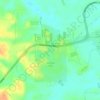
Chisa topographic map

Click on the map to display elevation.

About this map

Name: Chisa topographic map, elevation, terrain.

Location: Chisa, Iranduba, Amazonas, Região Norte, 69415-000, Brasil (-3.28802 -60.18509 -3.24802 -60.14509)

Average elevation: 45 m

Minimum elevation: 17 m

Maximum elevation: 64 m

Other topographic maps

Click on a map to view its topography, its elevation and its terrain.
Igarapé Acajituba

Brasil > Amazonas > Iranduba

Average elevation: 35 m

Praia do Açutuba

Brasil > Amazonas > Iranduba

Average elevation: 24 m

Cacau Pirera

Brasil > Amazonas > Iranduba

Average elevation: 27 m

Gear up for your next adventure:

💧Hydration Pack - Hands-free hydration system for long hikes
🧥Ultralight Puffy Jacket - Maximum warmth that packs down to the size of an orange
🥾Trekking Poles - Adjustable trekking poles to reduce knee stress and improve stability
🩹Compact First Aid Kit - Pre-packed essentials for common trail injuries
🌡️Emergency Mylar Blankets - Compact thermal protection for unexpected nights outdoors

As an Amazon Associate, this site earns from qualifying purchases at no extra cost to you.